And a tiny bit of the Outer Circle
After spending some days belting from one end of the state to the other, the next part of the program was to spend a few days in the city before heading back out to the bush. Melbourne boasts a couple of rail trails, that follow the old Inner and Outer Circle railway alignments. I was going to write about both, but since returning home and researching more about the outer circle, the amount of it I actually rode was insignificant. So this post is more about the shortish Inner circle route, but with a brief mention and a few photos of the bit of the Outer Circle I did. But lets get the history out of the way first.
The Inner circle line was first opened in 1888. It diverged off the Upfield line at Royal Park running across the northern suburbs of Melbourne, via the stations of North Carlton and North Fitzroy. Trains would either continue on towards Preston and Whittlesea, or Victoria Park (Run around) then on to Heidleberg. In 1901 a direct route from Flinders St to Victoria Park was completed, on which all Heidleberg trains, and some Preston trains used. Whittlesea trains still generally used the now indirect Inner circle line. The line retained a reasonable frequency of trains but the circuitous route and competition with trams running direct to the city discouraged high levels of patronage, and passenger services ceased in 1948, with both stations closing for passenger business. Freight trains continued to run (to a small spur to Fitroy) until 1981, at which time the line officially closed. The connection to the Epping Line (ex Whittlesea) was severed in 1965.
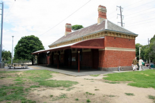
The alignment has been converted to a rail trail with some items of railway infrastructure still in evidence, including some parts of the overhead gantry that carries power between the Upfield and the Epping lines. There are also remnants of signals, some rails in old level crossings and two very much in use road over bridges. Oh, and the old North Carlton Station, which is now a community centre. The aspects of railway history make for some interest on this trail which – and possibly because by this time a few K’s had been racked up on country branches – is rather short. It does however form a connection with the Capital City Bicycle path, so a really interesting ride with some fantastic varieties of scenery can be made right into the city.
Our ride commenced at Clifton Hill, which was arrived at via a metro train from the City. After a mere 4.91 km, we have pretty well finished on the rail alignment, and were on the Capital City path. Still, it was a good ride, and it took me to parts of the city I have never seen before. I particularly enjoy some of the innovative land use that has resulted in the placement of some of these paths, which provides minimum road intersections that have to be crossed. Where a road crossing is necessary, cyclists have their own signal at controlled intersections – for someone from the backward Far North, this is heady stuff folks!
In the gallery there are also some pictures from a ride the next day on a tiny bit of the outer circle line. The bit from Alamein station toward towards the Glen Waverly line, until it merges with the gardeners creek bike path. Only a few k’s were ridden of an overall 18 km path, so that’s on the next time I’m down there list. One of the most striking things about the short section beyond Alamein is riding under the overhead gantries, as if you were on a previously electrified alignment. This is actually not the case – these were installed in the 1950’s – long after the line had been lifted, (apparently causing many locals to believe that re-commissioning the line was imminent) to provide railway power between the Alamein and Glen Waverly Railway lines. More explanations are in the image captions in the gallery…
.
View Inner Circle in a larger map


