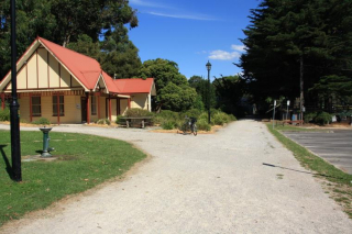
I rode the Warburton to Woori Yallock section of this trail about a year ago, which was duly reported on the blog I had going at the time. I enjoyed it so much I was determined to return and complete it from the Lilydale end. And so it came to pass, after completing the Beechworth Trail, we set forth towards Lilydale on Melbourne’s Eastern Outskirts.
The actual line from Lilydale to Warburton opened in 1901. The carried both goods (especially timber) and passengers, until 1964 when the passenger services ceased. The line was closed to all traffic in 1965 and was dismantled during 70’s. It has been reported that the line closed due to local busing interests getting into the ear of influential politicians, but I cannot confirm this. Anyway, with the rail trail, the corridor is maintained, as are all the bridges except for that which used to cross the Maroondah Highway, and a small section leased to a local school. I can’t help but think they might need that alignment in the future.
The trail is compacted gravel, with a distinct possibility that some of the surface has loosened through recent heavy rains. The trail is well signed, and on the Sunday we traveled over it, it was very busy. The scenery is superb, especially when you emerge from a deep cutting onto a high embankment, which provides you with breathtaking views of the Yarra Valley coutryside. Breathtaking because you have to start the ride by slogging over Mt Evelyn, climbing 100 meters in 4 km. But after that its down hill, pretty well all the way in to Worri Yallock.
And in some places pretty seriously down hill. Not the constant grade of the Beechworth Track, but after you top Mt Evelyn, you have a 3.5 km run down hill, at the same steepness as the previous uphill slog – slightly ruined by a busy road crossing about half way down. I mentioned the loose gravel – once you get a bit of pace up, you realise with a certain amount of alarm that you are not really in control of the bike, as it seems to make its own way down the path, despite any presumptions that you might have thinking you are actually steering it. Control to any degree only returns after a serious application of the brakes, but considering I managed not to slide off any of the embankments, it was great fun.
A more sedate pace is assumed once the track levels out a bit, and you can loosen your grip on the handle bars, enjoy the scenery and dodge the other not inconsiderable traffic on the trail. This a great trail to ride, and is well served by public transport if you need to return to where you left your car.
Only one station survives in anything like an intact state, which is Yarra Junction, which was not passed on this part of the ride (it is on the other side of Worri Yallock). It’s a pity that no others have survived. I remember as a kid during some holidays, walking the old alignment to Mt Evelyn with a couple of mates. The track had gone, but the ballast was still there, and Mt Evelyn station was fully intact, with its graceful curved platform, probably in 1971.
This here link takes you to my “sportypal” record of the ride. At the top of the map it displays, press the “Alt” link to get an overlay of the grades. Note that this was recorded by a fellow traveller, who left Lilydale about twenty minutes after me, but arrived at Woori at about the same time. Well, I had to get photos for this post, didn’t I? A track map is embedded beneath the gallery thumbnails.
If you’re solo, and only want to ride this one way, you can use the very convenient 683 bus that has a few stops convenient to the rail trail, especially at Lilydale, Woori Yallock, Millgrove and Warburton. This link will take you to the Metlink site for more info and timetables.
.
View Lilydale to Woori Yallock in a larger map


